Just J.Faye

Hiking & Other Adventures

  • Home
  • About
  • Index
  • Hikes
  • Travel
  • Recipe
  • Workout
  • Other things

Winter Yurt Trip

January 23, 2018 by Jenna

I went on a winter yurt trip to Clark Peak Yurt and it was super fun, so I want to tell you about it, because I think you need a yurt trip in your life.

Winter Yurt Trip

First of all, what is a yurt? A yurt is kind of like a cross between and hut and a tent. It has a round wooden lattice frame and is covered with canvas. There is no electricity or running water. There is a propane cookstove, an outhouse, and a wood stove used for heating the yurt and melting snow for water. You could call it glamping.

The Clark Peak Yurt looks like this:

Winter Yurt Trip

My friend Anna and I have been talking about wanting to do a yurt trip since forever. I think it was Memorial Day weekend 2016 to be specific. I had just learned what a yurt was and the idea of spending a weekend in one sounded awesome – cozy hut, snowshoeing, wood stove, pretty views, etc. What’s not to love?

We kind of forgot about the idea and didn’t make it happen last year, but then it resurfaced in December and I decided to look into it a little bit more. I told Michael about it and we started looking up options through Never Summer Nordic. There was nothing available aside from some random weekdays. Yurts are popular! I think you have to plan and book these things about 6 months in advance. However, we totally lucked out. The next morning Michael was scrolling through Instagram and saw this post by Never Summer Nordic – two weekends had opened up! We jumped at the chance and booked the Clark Peak Yurt that afternoon. I texted Anna immediately and we all marked the dates on our calendars: January 13-15.

Hurray!

We gathered a few other friends, cemented the plans, and headed up to the yurt the morning of January 13.

Winter Yurt Trip

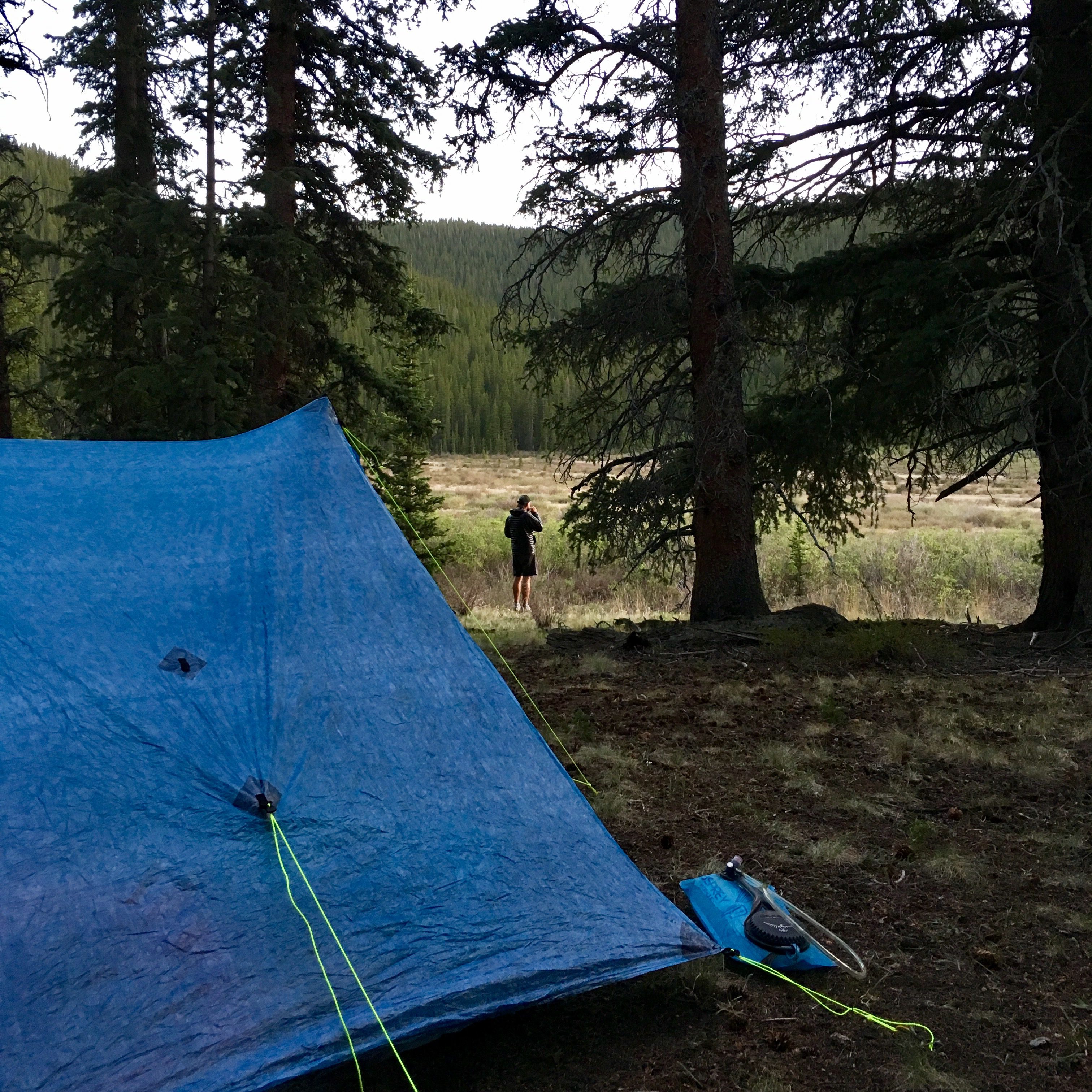
Packing for a yurt is interesting. It’s like packing for a backpacking trip – you need to pack in things like food, a sleeping bag, clothes, but, you don’t need a tent or camp stove. However, since it’s only a 2-mile snowshoe in you allow yourself to bring some bougey, glamping things like face wash, deodorant, lanterns, games, water bottles filled with alcohol, etc.

Here was my packing list:

  • What I wore: Feral Mountain Co hat, Mountain Hardwear Ghost Whisperer jacket, Patagonia R1 Hoodie, Fabletics Oula tank, sports bra, The North Face Winter Warm Tights, The North Face Aphrodite Straight Pants, Smartwool ski socks, Vasque St. Elias GTX hiking boots, Burton Gore-Tex mittons, sunglasses
  • Gear: Black Diamond trekking poles, Outdoor Research gaiters, MSR Evo Ascent snowshoes, REI Co-op Flash 60 Pack
  • Clothes in my pack: Darn Tough socks, Athleta Speedlight tank, gFast High Rise leggings, long-sleeve fleece, sports bra, underwear
  • Other things: Feathered Friends Egret UL 20 sleeping bag, Therm-a-Rest NeoAir XLite sleeping pad, CamelBak hydration vest, Black Diamond lantern, Petzl headlamp, Sea to Summit spoon, toiletries, phone charger, iPhone, camera, Gardetto’s, a couple of bars, wine

Michael carried in the rest of our food (Good-To-Go backpacker meals, mini packets of Seven Sundays muesli, some bars, trail mix, dried mangos, electrolytes, instant coffee) and our games (Five Crowns, Farkle, Yahtzee), because he’s the best and wanted to keep my pack as light as possible.

I should start doing those overhead “I laid out all my gear” pictures. Instead here’s what I looked like when we started snowshoeing:

Winter Yurt Trip

We drove up through the Poudre Canyon (passed the noosa farm!) where there was no snow and beautiful views. Minutes later as we drove up and around Cameron pass the ground was covered in snow and we were driving through a winter wonderland. Fortunately road conditions weren’t too terrible. We even saw a moose!

We stopped at the State Forest State Park Visitor’s Center to pick up some permits ($7/night/car) and use the restroom then headed to the parking area for the yurts.

It took us a couple of minutes to get geared up – snow pants, gaiters, hiking boots, mittens, snowshoes. It’s a lot to put on! We started our 2-mile snowshoe to the yurt at about 1:00.

Winter Yurt Trip

“Everybody point to the yurt!”

The weather temperature was perfect and we had slightly overcast skies. This made snowshoeing through the trees quite magical. It felt like we were either in Narnia or north of the wall. Fortunately, the hike wasn’t too steep. I did have a couple of “episodes” (where my heart goes a little off-rhythm and my ICD has to kick in and break it up), so I was a little distracted. It took us about 1.5 hours and we all made it to the yurt safe and sound!

We spent the rest of the afternoon playing in the snow. Our original plan was to build a snowman, but the snow just wasn’t sticky enough. Maybe next time. As it got colder and darker we moved our activities into the yurt.

Winter Yurt Trip

Winter Yurt Trip

Winter Yurt Trip

Winter Yurt Trip

As I mentioned before the yurt was equipped with a propane cooktop and wood stove. Inside there was wood, a giant snow melt pot, various pots and pans for cooking, 3 bunk beds (twin on top, full on bottom), a table, chairs, a mop and broom, soap, sponges, coffee mugs, plates, bowls, and eating utensils. There was also a bunch of food and games left back from previous guests. The outhouse was a short walk from the yurt that was filled with plenty of toilet paper.

Winter Yurt Trip

Winter Yurt Trip

The wood stove keeps the yurt nice and toasty, especially when filled with 6 people. We spent the rest of the night eating, drinking, and playing cards. It was fun to have a low-key silly night with friends.

Winter Yurt Trip

Before heading to bed, the boys loaded up the shelves with wood and found some hefty logs to fill the wood stove so that it would burn as long as possible. Michael did have to get up in the middle of the night and throw in some more, but overall I was surprised at how warm it was all night.

We woke up and took our time with breakfast and getting ready for snowshoeing. I think we all finally gathered ourselves a little after 10:00am. There are plenty of trails to explore around State Forecast State Park. Our plan was to head to Ruby Jewel Lake, which looked to be a 1.5/2-mile hike from the yurt.

The skies were bright blue and fresh, fluffy snow blanketed everything. We were all so in awe at how gorgeous it all was. It was stop-every-three-minutes-to-take-pictures gorgeous.

Winter Yurt Trip

Winter Yurt Trip

Winter Yurt Trip

Pro: The trail was very lightly traveled.

Con: The guys had to break the trail. This was exhausting for them, but worked out just fine for the ladies.

Winter Yurt Trip

It got more difficult to follow the trail (it was blazed with blue ribbons on trees) as we went on, so at about 1.75 miles in we decided to call it and start heading back to the yurt. Again, I had a couple of episodes while snowshoeing, so I was fine with heading back.

Winter Yurt Trip

Winter Yurt Trip

We only saw one other couple while we were out there. That is unheard of in Colorado! Usually the trail is filled with bunches of other people, but we had it all to ourselves. #luxury

When we got back to the yurt Anna, Shira, and Anni had to pack up and head back to Denver, so that just left Herbie, Michael, and I. We spent the night as we did the previous one – playing games and eating food while enjoying some wine and whiskey. I lost terribly at every single game of Yahtzee and Five Crowns. We did pause our play time to step outside and take in some beautiful alpine glow and, later, all the stars. Both of these things were hard to capture on camera, so you’ll have to trust me when I tell you that it was beautiful.

The next morning we woke up, packed up our stuff, cleaned up the yurt, took a few final pictures, and headed out. The whole process went quite quickly. Unfortunately, about 100 yards into the hike back to the car I started feeling a little light-headed. This isn’t abnormal for me, so I stopped to collect myself for a moment and starting walking again. Then I felt this shock go through my body as I fell to the ground. My ICD went off! It gave me a full on electric shock. This was the first time it had ever happened. Up until that point the only thing that had ever happened was that it would pace me out of a bad rhythm (like it had snowshoeing the previous two days). Fortunately, it didn’t hurt as bad as I thought it would and I felt fine afterwards.

Michael and Herbie were both troopers. They stayed calm, which was exactly what I needed, because if they started freaking out I would start freaking out more and we’d all be a mess. Plus, we still had to snowshoe 2 miles back to the car! Michael carried my pack, Herbie set a nice, even pace, and I focused on putting one foot in front of the other. I don’t know how I kept myself together, but I did. The rest of the hike was uneventful in the best way possible. When we got to the car we quickly striped off our gear and jumped in to start thawing. Then we headed back to Denver!

Winter Yurt Trip

I want to re-visit the defibrillator shock for one moment. I did feel fine afterwards and didn’t need any other therapy the rest of the day. At the time it happened I was weaning myself off of an anti-arrhythmic medication in order to start a new one. It was the third day after not taking any medication, so I think that’s why it happened.

Looking back I probably should not have gone on the yurt trip, especially while being in between medications. However, I was sick of not being active and not being able to fun things with my friends outside. It was a personal risk and I took it. Just wanted to live my life, you know? Fortunately, everything ended up fine. I’m thankful that it happened while I was outside with Michael and not while I was walking on the treadmill at the gym or something similar.

While I was on my previous anti-arrhythmic medication I basically went into ventricular tachycardia (VT) every day, sometimes more than once a day. I started taking the a new anti-arrhythmic medication last Tuesday and spent Thursday and Friday in the hospital getting a higher dosage. So far, no episodes! Michael and I went on a 3-mile walk on Saturday morning. I cried a little bit because I was so nervous it would happen again, but everything turned out fine. I am learning how to trust my body again.

Winter Yurt Trip

And back to the yurt…

Overall, it was such a fun trip! The whole experience (except the part where I got shocked, obviously) was so wonderful. I was thankful to be able to spend the weekend with friends, have outdoor adventures, and take in some gorgeous scenery.

You should probably book a yurt trip now. Just sayin’.

Winter Yurt Trip

Share this:

Filed Under: Hikes, Travel Tagged With: hiking, outdoor adventures, snowshoe, travel, weekend trips, winter

Exploring Glacier National Park

September 12, 2017 by Jenna

You need more than two days to explore Glacier National Park; however, if that is all you have it is still so worth it.

Exploring Glacier National Park

Why Glacier National Park?

Michael’s birthday was at the end of July and we each took a long weekend off of work to be able to go celebrate somewhere. After talking through a couple of options we landed on Glacier National Park. It is Michael’s favorite place in the lower 48 and I had never been, so it seemed like the perfect place to go.

The two downsides:

  1. With my heart issues we couldn’t go backpacking. Instead we car camped and hiked along some of the easier trails.
  2. Glacier is 14 hour drive from Denver plus time for gas, bio, and food breaks. Meaning we had one day to drive there, two days to explore, and one day to drive back.

Despite these downsides, we still managed to have a wonderful time.

Exploring Glacier National Park

The drive to Glacier National Park

We left Denver at about 5:30am Saturday morning equipped with hiking and camping gear, books about Glacier National Park, food, iced coffee, and some podcasts and playlists. It’s kind of difficult to just roll out of bed and start driving before the sun is up. I tried my best to be a good co-pilot while Michael drove, but I won’t lie, I had to take a quick little cat nap about 2 hours in. I’m the worst, BUT after than I was refreshed and ready to par-tay!

Honestly, the trip to Glacier National Park is not the most exciting drive. You essentially drive through alllll the boring parts of Wyoming and then allllll the boring parts of Montana. We took breaks when we needed gas, a bathroom, or food, but we kept them all pretty short. It was drive, drive, drive all the way to East Glacier.

This was our route:

map to glacier national park

We got into East Glacier at about 7:30pm and checked into the Circle R Motel. We dropped off our things and headed directly to dinner at Serrano’s Mexican Restaurant. Unfortunately, it was a 1.5 hour wait. We walked around the little shops in East Glacier while we waited. We drank a beer while we waited. I even had time to walk back to our motel to take a shower while we waited. Eventually we sat, ordered food, waited some more, ate, and then went straight to bed.

Day 1 in Glacier National Park

Our alarms went off at 6:00am Sunday morning. The original plan was to drive to Many Glacier Campground to try to get a spot there; however, Michael figured it would be full by the time we drove the 1.5 hours there. Instead we decided that Two Medicine would be the smarter choice, since it was closer to East Glacier and doesn’t typically fill up as fast.

We arrived at the campground and drove around and around scoping out the different sites that were open and then drove around and around a few more times and then finally landed on a site that we would call our home for the next two nights.

Exploring Glacier National Park

After setting up camp (and tracking down a place that sold coffee) we immediately headed out to explore. We drove along the Going To The Sun Road to the Logan Pass Visitors Center. I ooh’ed and ahh’ed at the scenery as Michael pointed out different sites and we both kept our eyes peeled for bears. We didn’t see any, but we did score big at the visitor’s center – it only took us a few minutes to find parking in the completely packed and busy lot.

First stop, bathrooms. Second stop, visitor’s center. Third stop, Hidden Lake.

The hike to Hidden Lake was about 5.5 miles. My top concern was to spot some mountain goats. Michael’s top concern was for me not to pass out. I’m happy to report that both of our concerns were taken care of.

Exploring Glacier National Park

On top of mountain goats and not passing out, we also got to experience beautiful scenery, bear grass, and lunch at a lake with the clearest water and stones so smooth I’m positive they were created specifically for skipping along the water.

Exploring Glacier National Park

Exploring Glacier National Park

Exploring Glacier National Park

After the Hidden Lake hike we continue to drive along the Going to The Sun Road. It was a beautiful drive around all the trees, lakes, and mountains. Apparently, I was tuckered out because I took another 10-minute cat nap. I’m the worst.

To help wake me up a little bit, we stopped at the Trail of the Cedars. Michael taught me about the different trees as we walked along the 1-mile path. There was an option to walk 1.6 miles out to Avalanche Lake and we started to take it; however, I was starting to get a little paranoid about my heart, so we cut it short and headed back to the car.

I heard Avalanche Lake is beautiful, but why risk it?

We continued along the Going To The Sun Road all the way to the Apgar Visitors Center at the edge of the park. Here we made the wonderful decision to buy National Park Yahtzee. We were both pretty excited about it, because we are both big dorks. Then we headed back to our campground with a pit stop to get gas and beer.

When we got back to our campsite we were able to chat with our camp neighbors a little bit who two very nice older men. These guys were great and had a lot of fun adventure stories to share – hiking all of the 14’ers, climbing various mountains, trail running, camping trips, etc. And let me tell you, they really know how to car camp! They enjoyed their meal of chicken parmesan and pasta, while Michael and I each made some ramen with our little backpacking stoves. Chicken flavored ramen and chicken parmesan over pasta are basically the same thing, right?

After dinner we played a couple of games of Yahtzee (so fun!!) and then took a nice walk along the campground.

Exploring Glacier National Park

Exploring Glacier National Park

Two Medicine is a very beautiful campground.

Day 2 in Glacier National Park

For our second day in Glacier we decided to hike along the Highline Trail. The Highline Trail Loop is one of the more popular trails in Glacier. It follows The Garden Wall to the Granite Park Chalet and then leads back down to Going To The Sun Road for a total distance of about 12 miles. To my surprise Michael had not already hiked it. The Highline Trail does parallel the Continental Divide Trail, which he hiked last summer, but this would be a new experience for the both of us.

We started from the Logan Pass Visitors Center. Unfortunately, we weren’t as lucky with parking this time around. It took much longer, but we eventually found a spot. That parking lot is stressful!

When we started hiking the Highline Trail we didn’t really have a plan – hike 1 mile and turn around? Hike a little more and turn around? Hike the whole loop? We just decided to take it slow and play things by ear.

Well, we ended up hiking the whole thing. It was just so beautiful I didn’t want to stop! Fortunately, there wasn’t much elevation gain, we hiked at a slow, steady pace, and I made sure to drink tons of water. Looking back this was probably a little bit risky. But hey, I survived!

The highlights of the Highline Loop:

About 2 miles into the hike, we spotted a mama and baby goat along the trail. The mom was busy eating grass to the left of the trail and the little goat was parkouring along the rocks to the right of the trail. It was the cutest thing! We were a little nervous to walk on the trail between the mom and baby, but we waited for a good time, went slowly, and made it.

Exploring Glacier National Park

I told Michael I was going to take a hiking selfie of us. I asked him if he was smiling. He said no.

Exploring Glacier National Park

These views:

Exploring Glacier National Park

If you had telescopic vision, you’d be able to see a mama grizzly and her cub in the little green space in the picture below. I wanted to see a bear from a safe distance, but this distance was maybe a little too safe? It would have been more exciting to see a bear just a little bit closer so that it would have looked more like a bear and less like a brown dot.

Exploring Glacier National Park

There are two things that I simply could not leave Glacier National Park without:

  • A stuffed mountain goat.
  • Huckleberry-flavored things.

Mountain goats are just about the cutest darn things (especially the babies). I bought a little stuffed one to go with Michael’s grizzly back in Denver at the Logan Pass Visitor’s Center once we were off the trail. The goat and grizzly are now best friends.

There are huckleberry flavored things all over the place in this area of Montana. Since I kept seeing things everywhere I couldn’t help but get a couple of huckleberry items to try. I am a marketer’s dream!! I got a huckleberry beer, a huckleberry ice cream sandwich, and a huckleberry salt water taffy (not at the same time, all the purchases were spread throughout the trip). Everything was actually pretty delicious!

Once we got back to our campsite we pretty much did the same thing we did the previous night: chat with our camp neighbors, cook ramen, play Yahtzee, walk around, and then hit the hay.

The drive Back to Denver

We took the more scenic route on the way back to Denver. We drove down through Kalispell, picked up some road-side cherries for a snack, and stopped in Missoula for lunch. We continued along 90 and stopped a little past Bozeman to fill up the gas tank. Here we saw a sign pointing to Yellowstone. At first, we just joked about driving through Yellowstone, which would take our drive from 17 hours to 20 hours. Then figured, “what the hell, let’s just do it”. So, we did.

It was more time to hang out, more time to spot wild life, and more time to see some pretty scenery.

Drive Through Yellowstone

Drive through Yellowstone

The detour was worth it, but it did make the rest of the drive – the boring parts of Wyoming in the dark late at night – difficult. We used the Harry Potter and the Prisoner of Azkaban audio book, McDonald’s burger and fries, and sour Haribo bears to survive. We made is safely back to Denver at about 3am Wednesday morning.

Thoughts on Glacier National Park

I would go back to Glacier National Park in a heartbeat. It’s a gorgeous park with so many things to offer – trails, views, backpacking, camping, etc. Two days exploring the area was definitely not enough time. It just whet my appetite and left me wanting more. I have no doubt that I’ll back. Hopefully next time will include more days and a backpacking adventure.

Plus, this trip served as a much needed break from the city. Michael and I both needed some quality time with each other and Mother Nature.

Exploring Glacier National Park

Share this:

Filed Under: Hikes, Travel Tagged With: glacier national park, hiking, travel

Colorado 14ers: Mount Harvard

July 25, 2017 by Jenna

It’s 14er season here in Colorado! Michael and I decided to bag our first one of the summer together on the 4th of July. Mount Harvard was our target.

Mount Harvard

For those that are not familiar, a 14er is a mountain peak that is above 14,000 feet. Colorado has 58 of them. The peaks range from easy to very difficult, but even the “easy” ones are a challenge. Gaining at least 2,500 feet of elevation and hiking above 10,000 feet where the air is nice and thin isn’t necessarily a breeze.

Mount Harvard

I hiked four 14ers last year (Grays, Torreys, Quandary, and Bierstadt) and hiked Evans a month ago. I’m still not sure if I can officially count Evans, because I started at Summit Lake and only gained 2,000 feet of elevation. The general rule of thumb is that you need to gain 3,000 feet for it to be legit. The jury is still out for debate on it.

( I think I’m going to count it.)

Mount Harvard is in the Collegiate Peaks Wilderness near the town of Buena Vista. It’s the third highest peak in Colorado, sitting at 14,420 feet. This 14-mile round-trip hike had 4,600 feet of elevation gain (and loss), so there is no need to debate this one. It was a doozy and I had an absolute blast.

Mount Harvard

To avoid waking up at 2:00 am and driving almost 3 hours to the North Cottonwood Creek Trailhead, Michael and I drove up the night before and camped at the trailhead. Not only did we get to “sleep in” until almost 5:00am, we also got to camp and start to acclimate to the altitude. Triple bonus.

There was an abundance of great campsites right off of the trailhead. The sun was already starting to set by the time got there, so we immediately started setting up the tent.

Actually, I lie. Michael set up the tent while I was busy making 14er signs. Because does climbing a 14er even count if you don’t take a picture with the sign at the top!? I’m not sure…

So anyways, Michael set up the tent while I made a sign. We each have our duties. Then we cooked/ate dinner and enjoyed a little fire before crawling into the tent for bed.

Mount Harvard

The 4:40am alarm felt really early, but I eventually dragged myself out of bed and started getting ready. Somehow I’m really slow in the morning and despite waking up 10 minutes before Michael, he was still ready before I was. I think I need to do a time analysis. There are definitely some process improvement opportunities here.

We hit the trailhead (9,900 feet) just before 5:30am following this route to the summit. The first few miles were mildly rolling hills through the trees, which was a nice warm up and a great way to settle into our “all day” pace. I’ve been dealing with some heart issues recently, so a gradual warm up (and a lot of water!!) really helps set me up for success.

Our first stop was at about mile 4 just below tree level for a quick bathroom and snack break. From here we started walking into some willow bushes, mountain run-off, and beautiful views of Harvard, Columbia, and the surrounding peaks. It was turning into a gorgeous morning with bright blue skies.

Mount Harvard

After crossing a stream the trail leveled out a little bit. We had a clear view of the peak of Mount Harvard, but still had quite a way to climb! At this point we started looking for marmots and mountain goats and Michael proposed a bet: Whoever saw the first marmot got to pick what we were eating dinner and whoever saw the first goat got to have dinner paid for them.

I lost both bets :/

Mount Harvard

From here we began to climb up a sort of stone staircase with switchbacks that led us up to a base of a nice, little snow field that basically went straight up. Yikes. The snow was covering the trail so it was difficult to know where to go. We took a quick break to put on our microspikes, eat some Sour Patch Kids, and figure out what route to take up. There was a guy in shorts and a t-shirt trying to climb straight up and it was very clear that he was struggling, so we free-formed switchbacks to the top of the snow field. Microspikes and trekking poles were a lifesaver here.

Mount Harvard

Once we got through the snow we ditched our microspikes and found the actual trail. There was a little bit more switchbacking (<- real word?) to a ridge and then it was the final push to the summit. And all of a sudden (7 miles and 3.5 hours later) we were at the peak of Mount Harvard at 14,420 feet!

Mount Harvard

Can you tell we are big fans of Feral Mountain Co?

Look at the gorgeous view!

Mount Harvard

We hung out at the summit for almost an hour – taking pictures, eating snacks, chatting with other hikers, watching marmots, and debating if we wanted to tack on Mount Columbia as well. In the end we decided not to. The trail up to the summit looked pretty snowy and the trail down is very steep and still being partially built. We’ll save Columbia for another time.

Once we got our fill of pictures, snacks, chatting, and marmots we turned back to head down to the trailhead the way we came. Another 7 miles and 3.5 hours later we were back at our car where we immediately put on sandals, chugged electrolytes, and headed back to Denver.

Mount Harvard

Overall, I loved the Mount Harvard hike! At 14 miles it was long, but it was also very gradual until, of course, the last mile to the summit. The views were beautiful both along the trail and at the summit. We also lucked out with beautiful weather. I highly recommend it!

Mount Harvard Stats:

  • Length: 14 miles
  • Type: Out and back
  • Beginning elevation: 9,900 feet
  • Elevation gain: 4,600 feet
  • Location: Buena Vista, CO
  • Trailhead: North Cottonwood Creek Trailhead
  • Route: South Slopes

Share this:

Filed Under: Hikes Tagged With: 14er, colorado, hiking

Quick Camping Trip in Eagles Nest Wilderness

July 11, 2017 by Jenna

A rare Saturday night and Sunday morning with no other commitments led to a spontaneous (and quick!) camping trip to Eagles Nest Wilderness.

Camping in Eagles Nest Wilderness

On Friday afternoon I shot Michael a text, “Throwing this out there: We could camp somewhere not too far away Saturday night and hike Sunday morning.” It didn’t take much to convince him that this was a great idea.

Next came the planning.

Turns out I’m pretty bad at it. There are just so many options for camping here in Colorado! It’s overwhelming. We were looking for an area that was less than 2 hours from Denver with 10-15 miles of hiking trails, minimal snow, and no permit/reservation required. After a lot of Googling and a trip to REI to ask the experts, we landed on a 10ish-mile backpacking loop in Eagles Nest Wilderness, just outside of Silverthorn.

And by “we”, I mean Michael. He’s the one that first came across Eagles Nest Wilderness and went to REI while I was working at the Brewery Running Series event at Cerebral Brewing.

I got home from the event, packed up my gear, and we were on the road by 3:00!

eagles nest wilderness

Eagles Nest Wilderness Gear

Since we were just backpacking for one night our packs were much lighter than they were in Lost Creek Wilderness. Here’s what I brought with me:

  • Gear: REI Traverse 48-liter pack, 20-degree sleeping bag, Therm-a-rest NeoAir sleeping pad, Black Diamond trekking poles, Etekcity camp stove, fuel, Sea to Summit long camp spoon, Etekcity water filter, Platypus bottle, Osprey 3-liter bladder, 1-Liter Smartwater, lighter
  • Toiletries: toothpaste, toothbrush, sunscreen, hand sanitizer, toilet paper, wet wipes, poop shovel.
  • Food: ramen noodle packet, tuna pouch, skratch hydration, instant coffee, oatmeal baggie (oats, protein powder, cinnamon)
  • Clothes I packed: Patagonia rain jacket, Mountain Hardwear puffy coat, long-sleeve shirt, leggings, 1 pair underwear, 1 pair of socks, hat
  • What I wore:  Patagonia Happy Hike shorts, Grandma’s Marathon t-shirt, Saucony Peregrine trail runners, sports bra, socks, sunglasses

I also packed some trail mix and protein bars that I didn’t eat.

eagles nest wilderness

Saturday Evening in Eagles Nest Wilderness

We parked our car at the Eaglesmere Trailhead (8700 ft) shortly before 5:00pm. It’s a little late to start heading out on a backpacking trip, but better late than never!

We walked along the gravel road to the Surprise Trailhead, crossed over the Cataract Creek, and headed onto the trail and into the forest. It was full of aspens, wildflowers, mosquitoes, and uphill hiking.

2 of the 4 things in that list were not so great. I’ll let you guess which ones.

eagles nest wilderness

I hope you guessed the mosquitoes and the uphills.

Luckily we put some deet on before starting the hike. Otherwise, we easily could have gotten eaten alive.

As for the uphill climb, I was on the strugglebus. I’m not sure if it was from the elevation, the climbing, or slight dehydration, but I was pretty light-headed for miles 2, 3, and 4. It didn’t feel great. I had to slow my pace way down and continue to suck down water.

eagles nest wilderness

Just over 3 miles into the hike we hit the split for Gore Range Trail. We took a right onto the trail and passed by Surprise Lake (10,050 feet). Since we were tight on time (and I was dragging my feet) we didn’t stop to gawk at the lake. I’m sure it was beautiful though. There was quite a few people camping near there. Maybe we’ll catch it next time.

We continued to hike on the Gore Range Trail. We crossed over a lot of fallen trees, rolling hills, and streams from mountain run-off. A few miles later we hit the Tipperary Lake Trail split. Our original plan was to camp at Eaglesmere Lake, but considering that it was already 7:00 and Eaglesmere was another 2 miles away we decided that Tipperary Lake was going to be our home for the night.

Tipperary Lake was about .1 miles from the trail split. It’s a small and marshy lake at about 9,770 feet.

eagles nest wilderness

A group of three men had already set up camp near the lake and had invited us to join them, which was great, because there were not many other options. We changed into warmer clothes, set up camp, and started up cooking dinner (ramen and dehydrated vegetables, classic). Michael pulled a chocolate bar and a little bottle of bourbon out of his pack. What a lovely surprise! He’s the best.

We ate, drank, and chatted with our camp neighbors. One of the men had been coming to camp at Lake Tipperary in Eagles Nest Wilderness for 25 years! So crazy!

We hung out and relaxed as the sun went down and the stars went up. It was a beautiful evening.

eagles nest wilderness

Sunday Morning in Eagles Nest Wilderness

We woke up on Sunday morning at about 7:30 to a gorgeous day! Can’t complain about waking up to views like this:

eagles nest wilderness

I cooked up my oats and ate breakfast on a boulder overlooking the lake. It was so peaceful. We finished packing up camp and hit the Gore Range Trail shortly after 8:30. Since we did most of the work (AKA uphill hiking) the previous day, our hike north to the Eaglesmere Trailhead was going to consist of some rolling hills and a lot of hiking down.

The landscape of Sunday’s hike was vastly different from Saturday’s. On Saturday we were primarily hiking through groves of tress with very little scenic views. On Sunday we were traversing through more open areas that exposed us to beautiful views of Lower Cataract Lake and Green Lake Reservoir. Also, there were a lot less bugs!

eagles nest wilderness

We were able to hike quickly and made it back to our car by 10:30.

The full loop was about 10.4 miles (5.5 miles on Saturday and 4.9 miles on Sunday) ranging in elevation from 8,700 feet to 10,300 feet. It was much less intense that our previous backpacking trip in Lost Creek Wilderness, but still totally worth it.

I love that we can decide late on Friday afternoon to go on camping trip and make it happen. Even though it was only 10 miles and one night, both of us came back to Denver on Sunday revived from hiking, breathing in fresh mountain air, watching the stars come out, and sleeping outside.

I highly recommend spending some time in the Eagles Nests Wilderness! I would love to go back and explore more of the area.

eagles nest wilderness

Share this:

Filed Under: Hikes Tagged With: backpacking, camping, colorado hikes, hiking

45-Mile Backpacking Trip in the Lost Creek Wilderness

June 27, 2017 by Jenna

The wilderness was calling. Neither Michael nor I had been backpacking since we went to Moab in January. We were way overdue for an overnight outdoor adventure, so we picked a weekend, took off work, and started planning a trip in the Lost Creek Wilderness.

45-Mile Backpacking Trip in the Lost Creek Wilderness

The original idea was to head down to Salida to camp and hike a couple 14ers (Shavano and Tabeguache, maybe Antero); however there was quite a bit of snow on the mountains, so we tabled that idea for another weekend.

Michael planned out a 45ish-mile loop for us to hike in 3 days. 45-MILE LOOP. This would definitely be the most hiking I’ve ever done. So far this year, I’ve gotten in a few 17-20 mile hikes, but those were just day hikes where I was carrying a small pack with some snacks and water and then went home to sleep in my comfortable bed afterwards. This would be carrying a pack full of camping gear and food, sleeping in a tent, and waking up for another full day of hiking (x2).

Somehow, it all seemed way more exciting than it did daunting. I knew Michael wouldn’t put me through something he didn’t think I could do, so I was all in.

This was our route:

lost creek wilderness 45-mile trail map

Lost Creek Wilderness Packing

Having hiked the PCT, the Colorado trail, and a portion of the CDT, Michael is expert on packing for adventures like this. As someone who tends to over-pack, I needed his help.

I laid out all my gear and let him walk through it. He took out my deodorant and soap (because we’re both going to smell anyways), gifted me a lovely poop shovel, and let me borrow his lightweight Therm-a-rest pad and old hiking poles.

Here is what I ended up with after the shakedown:

  • Gear: REI Traverse 48-liter pack, 30-degree sleeping bag, Therm-a-rest NeoAir sleeping pad, Black Diamond trekking poles, Etekcity camp stove, fuel, Sea to Summit long camp spoon, Etekcity water filter, Platypus bottle, Osprey 3-liter bladder, 1-Liter Smartwater, lighter
  • Toiletries: toothpaste, toothbrush, sunscreen, hand sanitizer, toilet paper, wet wipes, poop shovel, ibuprofen.
  • Clothes I packed: Patagonia rain jacket, Mountain Hardwear puffy coat, light long-sleeve shirt, leggings, 1 pair underwear, 1 pair of socks, hat
  • What I wore: sports bra, tank top, Athleta Trekkie shorts, socks, Saucony Peregrine trail runners, UV Insect Shield Buff, sunglasses

The plan was to hike in the same clothes every day and wear the items in my pack while at camp. Michael carried the tent in case you were wondering where that important piece of gear was hiding.

Based on long marathon training runs and longer hikes, I know that I typically need a snack every 4-5 miles (~2 hours) to avoid bonking. I assumed 8 hours of hiking per day, along with 2 breakfasts and 2 dinners and ended up with:

  • Breakfasts: instant oatmeal packet (x4), instant coffee (x2)
  • Dinners: ramen noodle packet (x2), salmon pouch (x2)
  • Hydration: 3 Nuun tablets, 4 Scratch packets, 3 Crystal Light packets
  • Snacks: 3 packets Justin’s nut butter, 6 bars (variety of brands like this and this), 3 small baggies of trail mix, and 3 packets of gummies/energy chews.

I either packed too many snacks or didn’t eat enough throughout the day, because I didn’t eat a packet of Justin’s, 3 bars, a bag of trail mix, and a packet of energy chews. I’d rather have a few snacks leftover than not have enough to eat, but it also would have been nice to carry a little less weight. It’s a fine line, but is something I’ll learn with time.

Lost Creek Wilderness Day 1:

Michel and I left Denver for our backpacking adventure in the Lost Creek Wilderness adventure early Saturday morning, a 2-hour drive. We started a little after 10:00am from the Goose Creek Trailhead (8,200 feet elevation) and headed west on the Hankins Pass Trail. Our plan for the day was to get in at least 15 miles, hoping to hit closer to 17-18 miles.

lost creek wilderness

The weather was warm with bright blue skies and a nice, cool breeze. It was pretty ideal; however, I was struggling. It took me a while to get adjusted to carrying a heavy pack, utilizing trekking poles, and hiking at 8,000+ feet of elevation. Not to mention the trail was basically up and up and up the entire day. I was breathing heavy and was slightly uncomfortable, but I kept chugging along putting one foot in front of the other knowing that it would (hopefully?!?!) get easier.

We took our first break after about 4.5 miles at the junction for Lake Park Trail (10,000 feet elevation). Despite the difficulties I was still all smiles.

lost creek wilderness

Lake Park Trail started taking us north and kept us climbing up (11,560 feet elevation) and down through aspens, pines, and red rock formations until we reached the Brookside-McCurdy Trail (10,750 feet elevation). From here we continued heading north and heading up. We reached an old burn area with views of Bison Peak, McCurdy Mountain, and more distant mountains.

lost creek wilderness

lost creek wilderness

At this point we were about 14 miles in and I was definitely feeling the hike and the elevation. We stopped for a quick electrolyte and snack break and prepared ourselves for the final push of the day, a climb up to 11,900 feet.

The views were so spectacular. I had tears in my eyes, which could have been caused either by the beautiful views of Pikes Peak or by the wind whipping across my face.

lost creek wilderness views of pikes peak

It was all down hill from there. Literally. Within a few miles we dropped down to about 10,000 feet and ended at a little creek. We stopped to fill up our water and began keeping our eyes peeled for a spot to set up camp… and for moose. At this point we were wandering through a bunch of willow bushes and came across a lot of moose droppings. But alas, no moose 🙁

After another mile(ish) of searching we found a spot and started setting up camp. We put on our warm clothes, cooked dinner, brushed teeth, took some Advil PM, and climbed into the tent.

lost creek wilderness

I officially survived Day 1!

Day 1 Stats: 18 miles; 4,400 feet elevation gain

Lost Creek Wilderness Day 2:

We woke up at about 8:30am to another beautiful day! After rolling out of the tent, we began cooking breakfast, taking down the tent, and getting ready for the day.

Breakfast was two packets of instant oats mixed with instant coffee and some goji berries and mullberries. Yum!

lost creek wilderness camp breakfast

We hit the trail at 9:30am with a planned stop at the Lost Park campsite to use the facilities (no offense, poop shovel) and fill up on water. From there it was 2 miles until we connected with the Colorado Trail and started heading east. Michael hiked the entire Colorado Trail last summer and was reliving some memories. I love hearing about his adventures and try to not get too jealous while I’m listening. Maybe one day I’ll get to hike the entire trail.

Colorado Trail

I was feeling ok at the start of Day 2. Despite all the previous day’s climbing, my legs felt surprisingly great and my shoulders were only a little sore. However, my pack felt super uncomfortable on my back, almost like a sharp pain from my left shoulder-blade to my neck. We were in the middle of a short climb (about 500 feet) and I absolutely had to stop to make some sort of adjustment. I took off my pack and found a pea-sized rock lodged by the zipper just about my left shoulder strap. That was the little rock was the cause of all my pain! I felt infinitely better after that. I cannot begin to describe how relieved I was.

Again, all smiles at our snack break.

lost creek wilderness

The Colorado Trail led us on an old logging road through aspens and ponderosa pines, where we dropped about 2,000 feet over 6 miles to about 8,400 feet. We took advantage of the easy hiking and moved quickly, because our goal was to reach 20 miles.

Colorado Trail

From the Colorado Trail we got onto Rolling Creek Trail and started heading south. The trail was pretty gentle, so we continued to hike quickly. About a mile into Rolling Creek Trail we stopped for a quick bio break. I peeled off my pack and revealed two large blisters at the top of each collarbone. This will teach me to wear a tank top while carrying a heavy pack! Michael put moleskin and tape over each blister and I changed into a t-shirt.

I’m such a rookie.

After another mile of nice and easy hiking the trail crossed Rolling Creek and then went straight up. This is not an exaggeration. The trail was STEEP. We gained about 2,200 feet in about 2.5 miles. The first mile or so was through a gorgeous canyon, but I was too busy charging up the mountain to stop and take any pictures.

I just took mental pictures, please believe me when I tell you it was stunning.

At the top of the canyon we took a much needed water and sugar break – Sour Patch Kids ftw!! We then continued on switchbacks and headed up and up. About a half-mile from the top we were both out of water. I was running on sugar and adrenaline alone and actually felt pretty good. We made it to the top (10,650 feet elevation), high-fived each other, and immediately started going down, dropping 1,000 feet in a little over a mile.

This is about when I realized I was in love with trekking poles. They helped me hike swiftly during the flat parts of the trail, helped me stay upright and led to easier climbing on the steep uphills, and helped steady me and ease the pressure on my knees during the descent. I guess it’s just one more piece of equipment I need to invest in!

We eventually made it down to Wigwam Park (<- best name) and found a spot to camp next to a little creek.

lost creek wilderness

Michael and I were both drenched in sweat, so we immediately changed into dry clothes and hung our sweaty ones out to dry. I felt like I did after my 20-mile training runs – sweaty and drained, yet full of endorphins. It’s an odd combination.

Michael set up camp while I filtered water and then we followed the same routine as the previous night – cook dinner, brush teeth, take Advil PM, and crawl into bed.

It was ramen noodles and salmon for me, while Michael had bougey Pad Thai.

lost creek wilderness camp dinner

Day 2 was complete! I think we passed out by 9:00pm.

Day 2 Stats: 20 miles; 3,100 feet elevation gain

Lost Creek Wilderness Day 3:

We woke up at about 9:30am to our final day of hiking! Having already covered 37 miles we only had about 10 miles of rolling hills to go and planned to knock them out quickly.

Our hiking clothes were still slightly damp with sweat, so we moved them into the sun, crossed our fingers, and hoped that they would be dry after we ate breakfast and packed up camp. Thankfully, they were.

No one likes putting on a sweaty sports bra.

We hit the trail by 10:30am, heading east on the Wigwam Trail along some beaver ponds. After about one-half mile we turned south on Goose Creek Trail. From here is was a short 9.4 miles back to the car.

“Short” is relative. Compared to the previous days of 17- and 20-milers, 9 miles felt like nothing.

lost creek wilderness

The trail began with a 650-feet incline over about 2 miles. There was less “pep in my step” (as Michael put it) on this day, but I still felt pretty good overall – just a little pokey. From there it was rolling hills and gorgeous views down to the Goose Creek Trailhead. We took some very quick breaks (less than 2 minutes quick) here and there to take pictures, but basically charged through the miles.

lost creek wilderness

And then… we made it!!

Michael mapped and tracked everything using the Gaia app. Our total stats according to the app were:

  • Total distance: 46.85 miles
  • Ascent: +8,572 ft
  • Descent: -8,652 ft

Sometimes we didn’t pause it on breaks. Sometimes we did. Sometimes we forgot to re-start it. All in all, we probably hiked a little over 47 miles in 51 hours (including sleep and breaks).

Not too shabby for my first 3-day backpacking trip.

lost creek wilderness

After getting off the trail, we put on sandals (the most relieving feeling ever), hopped in the car, and headed back to Denver with a pit stop for Gatorade, because: dehydrated.

We celebrated the amazing weekend with long showers, steak salads, beer, and conversations about future adventures.

Lessons Learned in the Lost Creek Wilderness:

As a newbie at this whole backpacking thing, I learned a lot of lessons.

  1. Wear a t-shirt (or a muscle tank) to help eliminate collarbone blisters.
  2. When filtering water do not put the cap of the container that holds the dirty water onto the cap of the container with the clean water unless you want to risk getting giardia.
  3. Be careful when taking off hiking shoes at camp, because you might step in a bunch of burs. If you step in burs and try to put on leggings, burs will line the inside of your leggings and you will spend the next 15 minutes trying to pick them all off. The smarter idea is to change in the tent.
  4. A 3 lb 6oz sleeping bag is heavy and takes up a lot of space in a backpack. Either live with that weight or return it and splurge on one from Feathered Friends that only weights 1 lb 12 oz.
  5. Trekking poles are life savers.

Those are just the obvious ones.

Lost Creek Wilderness

I would strongly recommend a backpacking trip in the Lost Creek Wilderness. We covered 47 miles, but there are 130 miles of trails to explore ranging from shorter day hikes to longer backpacking trips. Reach more about the different trails here.

Overall, it was an incredible weekend. I’m so glad Michael and I could get away and spend 3 days out in the wild. It was full of challenges (heavy pack, high mileage, steep climbs) and many rewards (quality time with Michael and nature, beautiful views). I’d go again in a heartbeat and look forward to many more adventures like this to come!

lost creek wilderness

Share this:

Filed Under: Hikes Tagged With: backpacking, camping, colorado, hiking

Colorado Hikes: Sky Pond

October 17, 2016 by Jenna

Another beautiful Colorado Hike coming your way! This time it’s Sky Pond.

Colorado Hikes: Sky Pond

There is something about alpine lakes tucked into mountains that I absolutely love. Maybe it’s because they look like like this:

Colorado Hikes: Sky Pond

Maybe.

Compared to Gem Lake, the hike to Sky Pond is a little bit longer and a little bit more difficult, but just as awesome. This hike had been on my radar for a while, but I finally got to move it from the “must hike” list to the “this hike was awesome” list back in early September.

We (“we” being myself and a guy that I dated for a few weeks that I am no longer seeing, so he will only be mentioned as a generic “he” throughout this post) set out from Denver super early on September 10 to drive out to Rocky Mountain National Park. Our goal was to get there slightly before sunrise (6:30am), but it ended up being closer to 7:00am. The parking lot at Glacier Gorge was already full, so we parked at an overflow lot about ½-mile down the road. Bonus hiking miles!

For it being early September, the weather was a nice little fall preview. Brisk air in the morning with sunshine, bright blue skies, and some colorful aspen trees. It was a little chilly at the start, but we warmed up quickly with the sunshine and the hiking.

Be aware as there are some forks in the road during the first few miles, so make sure to follow the signs towards Loch Vale and Sky Pond. If you take a wrong turn, you’ll still end up someplace awesome (like Lake Haiyaha, which is on my “must hike” list), just not where you originally intended.

One great thing about this hike is that there are many things to see along the way – Sky Pond is not the only attraction! The first is Alberta Falls, which is just about one mile into the trail and is a 30-foot scenic little waterfall.

Colorado Hikes: Sky Pond

After Alberta Falls the incline begins to pick up and the switchbacks begin. Two miles later the trail brings you to the next landmark: Loch Vale.

“The Loch”, as it’s called, is a little subalpine lake surrounded by mountains. This would be a good place to stop if you need a little rest and/or snack.

Colorado Hikes: Sky Pond

From here the trail stays flat for only a short while and then the stairs begin and it gets nice and steep. Like I-definitely-can-tell-I’m-over-10,000ft-elevation steep. At this point my heart rate was pretty high and I was feeling light headed, but then I turned around and took in the views and everything was a-ok.

Colorado Hikes: Sky Pond

The stairs lead you right to the base of Timberline Falls, which is about 4 miles from the beginning of the hike.

Colorado Hikes: Sky Pond

Here is where the fun part begins: scrambling up some rocks. This was the first time I’ve ever had to do much scrambling during a hike. It was both terrifying and exhilarating. Because of the cooler morning temps, there was some ice on the rocks; however, I just took it slow with small movements and some advice from that guy and made it up in one piece.

Then you see a lake and it’s like “YAY! I made it to Sky Pond!” only to realize that it’s not. We weren’t expecting this one and totally would’ve stopped there if someone hadn’t told us that it was, in fact, Glass Lake. Other hikers are so helpful.

I didn’t mind that it was there though. It was beautiful.

Colorado Hikes: Sky Pond

The remaining trail to Sky Pond was quite tricky, as in we lost the trail and climbed over a bunch of rocks until we found it again. Then a little stone path a few steps lead right to it.

Colorado Hike: Sky Pond

Sky Pond is about 4.5 miles from the trailhead and sits surrounded by cliffs at about 10,900 feet. It was crazy windy, so we found a little cove that somewhat blocked the wind and had our lunch of pb&j, cheddar pretzels, and peanut butter oatmeal cookies. We were only two of a few people there at the time. It was very peaceful and we just sat and took in the scenery, watching the climbers in the distance and keeping our eyes on the marmots.

Colorado Hikes: Sky Pond

I still can’t believe how blue those skies were, especially when contrasting against the white/gray of the mountains.

It’s times like that when I realize how much I truly love hiking and being in the mountains. All the miles and climbs and gasping for air are totally rewarded.

And then my heart races in a different sort of way.

Colorado Hikes: Sky Pond

We hung out at Sky Pond for about 45 minutes and then started to head back towards the trailhead. Luckily on the way back we found the proper trail from Sky Pond to Glass Lake. It made things much easier.

It’s always interesting to hike trails in reverse. It’s the same scenery, but in a different perspective and in a different light of day.

As we were going down there were quite a few people just beginning their way up. We even passed by a little elk family chilling in the woods near the trail.

Colorado Hikes: Sky Pond

The round trip hike is about 9 miles, but with our bonus miles to the overflow lot and some additional wandering we ended up at about 10.6 miles. It was such a fantastic hike and ended up being a gorgeous day, so we decided to celebrate with some post-hike beers at The Barrel in Estes Park.

I hope you give this one a go!

Colorado Hikes: Sky Pond Colorado Hikes: Sky Pond

Here are some additional tips:

Sky Pond Stats:

  • Length: 9.0 miles
  • Type: Out and back
  • Beginning elevation: 9240 feet
  • Elevation gain: 1780 feet
  • Location: Estes Park, CO
  • Trailhead: Glacier Gorge Trailhead
  • Bathrooms: Yes

Weather, Clothes, and Food:

  • Weather: 50s at the start, but climbed up into 80s towards the end of the hike. Bright blue skies, but quite windy in the higher elevation.
  • Time of year: early September
  • Duration: About 6.5 hours, but we hung out at Sky Pond for 45-60 minutes.
  • Outfit: Eddie Bauer hiking pants, Athleta Chi tank, Under Armour quarter zip, Merrell hiking shoes, Smart Wool running socks, and The North Face rain jacket
  • Extras: Patagonia backpack, sunscreen, and sunglasses along with water and sandals for after the hike
  • Snacks: pb&j, cheddar pretzels, peanut butter oatmeal cookies, Quest bars, water, and no beer (because we forgot it)

Colorado Hikes: Sky Pond

Share this:

Filed Under: Hikes Tagged With: colorado, colorado hikes, hiking, rocky mountain national park

  • « Previous Page
  • 1
  • 2
  • 3
  • 4
  • 5
  • Next Page »

hello and welcome!

my name is jenna, but you can call me j.faye. i am a lover of food, mountains, and sunshine. read more…

Follow Me

  • Bloglovin
  • Facebook
  • Instagram
  • Pinterest
  • Twitter

Never Miss A Post

receive updates via email:

Instagram

jenna.faye.ivey

Thankful for this crew ❤️ Thankful for this crew ❤️
Winter mode: activated. #snow #winter #mountains Winter mode: activated. 

#snow #winter #mountains #mountainlife #getoutside #outdoors #coloradohikingmoms #keepthelittleswild #liveferal #boymom #colorado #outdoorkids
Hike-or-treat & trunk-or-treats! It was a fun Hall Hike-or-treat & trunk-or-treats! It was a fun Halloween week with our little Mickey 🎃
The leaves. The views. The company! What an incred The leaves. The views. The company! What an incredible experience for our first two-nighter and last camping trip of the year (probably).

Thanks to @adventuresinnoticing & @anni_martini for being amazing friends/aunties. 

#colorado #camping #fall #leafpeeping #mountains #keepthelittleswild #coloradohikingmoms #feraldenver #outdoorsymom #boymom #dogmom #getoutside #lifeoutdoors #lifeofadventure
Cozy season is officially here ✨ #fall #cozy #c Cozy season is officially here ✨

#fall #cozy #camping #keepthelittleswild #coloradohikingmoms #getoutside #lifeofadventure #motherhood #family #boymom #dogmom #outdoorsymom #rimby #coloradomom
My open heart surgery was 7 years ago and it’s a My open heart surgery was 7 years ago and it’s an anniversary I will never not celebrate. 

I carried a lot of trauma with me for a long time. I was nervous for every hike, every workout, religiously checking my heart rate, wondering if this would be the time my heart fails me again. Very dramatic, I know. But I kept at it, doing these things I love to do, working through the fear. Now the intrusive thoughts are few and far between. 

So here I am 7 years later, a stronger person both physically and mentally, hanging out at the top of a mountain with my babies after a nice, challenging hike.  It’s all I really want. 

I’m so grateful for this life and for the people who continue to support me ❤️

#openheartsurgery #heartwarrior #myocardialbridge #heartattacksurvivor #recoveryjourney #celebrate #adventure #lifeoutdoors

Copyright © 2025 · Foodie Child Theme by Shay Bocks · Built on the Genesis Framework · Powered by WordPress